
Famous landmarks in Armenia
3 landmarks
Armenia on My Earth Toy, the free 3D toy globe for kids: 3 landmarks. Here you can see its flag, capital and size, then fly to every place on the globe.
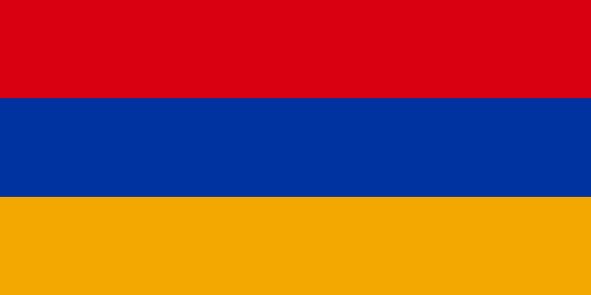
The flag of Armenia has three equal horizontal stripes: red on top, blue in the middle and orange at the bottom.
Read about this flag →Armenia at a glance
- Capital
- Yerevan
- Area
- 29,743 km²
- Population
- 3 million
Armenia is a small, mountainous, landlocked country in the South Caucasus, where Europe and Asia meet. Its capital is Yerevan, and about 3 million people live there. Armenia is known for its ancient stone monasteries, its own alphabet, apricots, and the view of snow-capped Mount Ararat, which rises just across the border in Turkey. Its people have kept their language, faith and traditions alive for thousands of years.
On My Earth Toy you can visit Khor Virap monastery with Mount Ararat behind it, Geghard Monastery, partly carved into the cliffs of a gorge, and the Mother Armenia statue holding a sword above Yerevan.
Geography and nature
Armenia sits on a high plateau, and much of the country is more than 1,000 metres above sea level. Its highest peak is Mount Aragats. Lake Sevan, a large, cool mountain lake, is one of the biggest high-altitude freshwater lakes in the world. Summers are hot and dry, and winters can be very cold and snowy. Deep river gorges, forests in the north and orchards of apricots and grapes in the valleys give the land a lot of variety.
People, languages and culture
Almost everyone in Armenia is Armenian and speaks Armenian, which is written in its own 38-letter alphabet. Many more Armenians live abroad than in Armenia itself, in places such as Russia, the United States and France. The Armenian Apostolic Church is very important to national life. Lavash, a thin flatbread baked in a clay oven, is part of daily meals, and its making is listed by UNESCO. Chess is so popular that it is taught in schools.
History in a nutshell
Armenia has one of the oldest cultures in the world. Yerevan traces its founding to the fortress of Erebuni in 782 BC. In the early 300s AD, Armenia became the first country to make Christianity its state religion. Around 405, the scholar Mesrop Mashtots created the Armenian alphabet. Over the centuries Persians, Byzantines, Arabs, Ottomans and Russians ruled the area. Armenia became part of the Soviet Union and gained independence in 1991.
Fun facts
- Armenia is widely counted as the first country to adopt Christianity as its official religion.
- The apricot's scientific name, Prunus armeniaca, refers to Armenia.
- A leather shoe about 5,500 years old, one of the oldest ever found, was discovered in a cave in Armenia.
- Parts of Geghard Monastery were carved directly out of a solid rock cliff.
Famous landmarks in Armenia
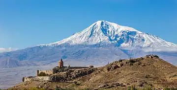
Mount Ararat & Khor Virap
Armenia · Other
An Armenian monastery set against snow-capped Mount Ararat (5,137 m), a key Christian pilgrimage site.
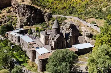
Geghard Monastery
Armenia · Other
A medieval monastery partly carved into the cliffs of the Azat gorge, with rock-hewn churches and a conical-domed church.
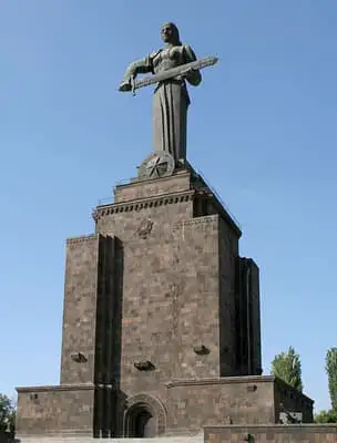
Mother Armenia
Armenia · Other
A sword-bearing female figure in Victory Park watching over Yerevan, symbolising peace through strength.
Questions
What is the capital of Armenia?
The capital of Armenia is Yerevan.
How big is Armenia?
Armenia covers about 29,743 km².
How many people live in Armenia?
About 3 million people live in Armenia.
What are the most famous landmarks in Armenia?
Some of the best-known landmarks in Armenia are Mount Ararat & Khor Virap, Geghard Monastery and Mother Armenia. My Earth Toy has 3 landmarks from Armenia on its free 3D globe, each with a photo and quick facts.
Sources
Updated: 2026-10-30