
Djibouti: landmarks, animals & facts for kids
1 landmark
Djibouti on My Earth Toy, the free 3D toy globe for kids: 1 landmark. Here you can see its flag, capital and size, then fly to every place on the globe.
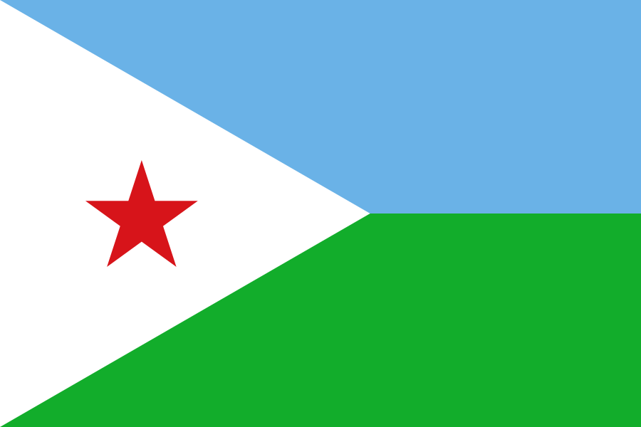
Djibouti's flag has a light blue stripe over a green stripe, with a white triangle at the flagpole side holding a red five-pointed star.
Read about this flag →Djibouti at a glance
- Capital
- Djibouti
- Continent
- Africa
- Area
- 23,200 km²
- Population
- 1.2 million
Djibouti is a small country in the Horn of Africa, on the strait that connects the Red Sea with the Gulf of Aden. It is bordered by Eritrea, Ethiopia and Somalia. Its capital, also called Djibouti, is a busy port city where more than half of the country's roughly 1.2 million people live. Djibouti is known for its strange volcanic landscapes, salt lakes, hot climate and its important position on one of the world's busiest shipping routes.
On My Earth Toy you can see the limestone chimneys of Lake Abbe, tall rock towers that puff out steam from hot springs. The eerie landscape looks so otherworldly that it was used as a filming location for the 1968 film Planet of the Apes.
Geography and nature
Djibouti lies in the Afar Triangle, where three pieces of the Earth's crust are slowly pulling apart, creating cracks, volcanoes and deep depressions. Lake Assal, a crater lake surrounded by white salt flats, is about 155 metres below sea level, the lowest point in Africa. Most of the land is dry desert and rocky plateau, with very hot summers. In the Gulf of Tadjoura, whale sharks gather in the cooler months to feed.
People, languages and culture
The two largest groups are the Somali, mostly of the Issa clan, and the Afar. French and Arabic are the official languages, while Somali and Afar are spoken every day. Almost everyone is Muslim. Many Afar and Somali people have long been nomadic herders of camels and goats. Spiced rice with meat and a spongy flatbread called lahoh are everyday foods. Traditional dances are performed at weddings and festivals.
History in a nutshell
People have crossed and traded through this region for thousands of years; it may have been part of the ancient Land of Punt that Egyptians traded with. In the late 1800s France took control and called it French Somaliland, later the French Territory of the Afars and the Issas. A railway built from the port to Addis Ababa made the city important. Djibouti became independent on 27 June 1977.
Fun facts
- Lake Assal is far saltier than the ocean, and salt has been collected there for centuries.
- Djibouti sits beside the Bab-el-Mandeb, a strait whose name means 'gate of tears'.
- Several countries keep military bases in Djibouti because of its location on the shipping route to the Suez Canal.
- Djibouti is one of the hottest countries in the world.
Famous landmarks in Djibouti
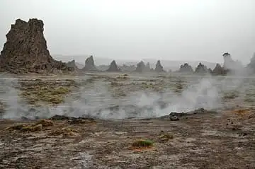
Lake Abbe limestone chimneys
Djibouti · Africa
On the shore of salty Lake Abbe on the Ethiopian border, dozens of limestone chimneys built by hot springs rise from the flats, some still steaming, like a landscape from another planet.
Questions
What is the capital of Djibouti?
The capital of Djibouti is Djibouti.
Which continent is Djibouti in?
Djibouti is in Africa.
How big is Djibouti?
Djibouti covers about 23,200 km².
How many people live in Djibouti?
About 1.2 million people live in Djibouti.
What are the most famous landmarks in Djibouti?
On My Earth Toy's free 3D globe, the landmark from Djibouti is Lake Abbe limestone chimneys, with a photo and quick facts.
Sources
Updated: 2026-10-30