
Burundi: landmarks, animals & facts for kids
1 landmark
Burundi on My Earth Toy, the free 3D toy globe for kids: 1 landmark. Here you can see its flag, capital and size, then fly to every place on the globe.
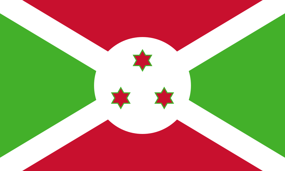
The flag of Burundi is divided by a white diagonal cross into red and green triangles, with a white circle in the middle holding three red stars outlined in green.
Read about this flag →Burundi at a glance
- Capital
- Gitega (political capital); Bujumbura is the economic capital
- Continent
- Africa
- Area
- 27,834 km²
- Population
- 14 million
Burundi is a small, landlocked country in East-Central Africa, in the Great Lakes region, bordered by Rwanda, Tanzania and the Democratic Republic of the Congo. Lake Tanganyika lies along its southwest. Its political capital is Gitega, and its largest city and economic centre is Bujumbura. About 14 million people live there, making it one of the most densely populated countries in Africa. Burundi is known for its green hills, coffee and tea, and its royal drummers.
On My Earth Toy you can see the Source of the Nile Pyramid at Rutovu, a small stone pyramid near a spring that is counted as one of the southernmost sources of the world's longest river.
Geography and nature
Burundi sits on high, rolling hills and plateaus, much of it more than 1,500 metres above sea level, which keeps the climate mild. In the west, the land drops steeply into the Great Rift Valley and Lake Tanganyika, one of the deepest and oldest lakes in the world, full of colourful fish found nowhere else. Rusizi National Park, near Bujumbura, has hippos, crocodiles and many birds. Most of the original forest has been cleared for farms.
People, languages and culture
Burundi's people are Hutu, Tutsi and Twa, and nearly everyone speaks Kirundi, which is also an official language, along with French and English. Most people are Christian and live in the countryside, farming beans, bananas, cassava and coffee. The Royal Drum Dance, in which drummers carry huge drums on their heads and leap as they play, is listed by UNESCO as cultural heritage. Drums have long been symbols of power in Burundi.
History in a nutshell
For centuries Burundi was an independent kingdom ruled by a king called the mwami. In the late 1800s it became part of German East Africa, and after World War I Belgium governed it together with Rwanda as Ruanda-Urundi. Burundi became independent on 1 July 1962. It went through long periods of conflict between groups, including a civil war that lasted from 1993 to about 2005, and has since worked to rebuild.
Fun facts
- Lake Tanganyika is the second-deepest lake in the world, more than 1,400 metres at its deepest.
- Coffee is one of Burundi's most important exports.
- The sacred royal drum of the old kingdom was called Karyenda.
- Burundi's flag has three green stars in a white circle, for unity, work and progress.
Famous landmarks in Burundi
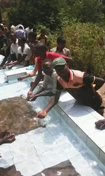
Source of the Nile Pyramid (Rutovu)
Burundi · Africa
A small stone pyramid on Mount Gikizi in Burundi marking the spring held to be the southernmost source of the Nile.
Questions
What is the capital of Burundi?
The capital of Burundi is Gitega (political capital); Bujumbura is the economic capital.
Which continent is Burundi in?
Burundi is in Africa.
How big is Burundi?
Burundi covers about 27,834 km².
How many people live in Burundi?
About 14 million people live in Burundi.
What are the most famous landmarks in Burundi?
On My Earth Toy's free 3D globe, the landmark from Burundi is Source of the Nile Pyramid (Rutovu), with a photo and quick facts.
Sources
Updated: 2026-10-30