
Equatorial Guinea: landmarks, animals & facts for kids
1 landmark
Equatorial Guinea on My Earth Toy, the free 3D toy globe for kids: 1 landmark. Here you can see its flag, capital and size, then fly to every place on the globe.
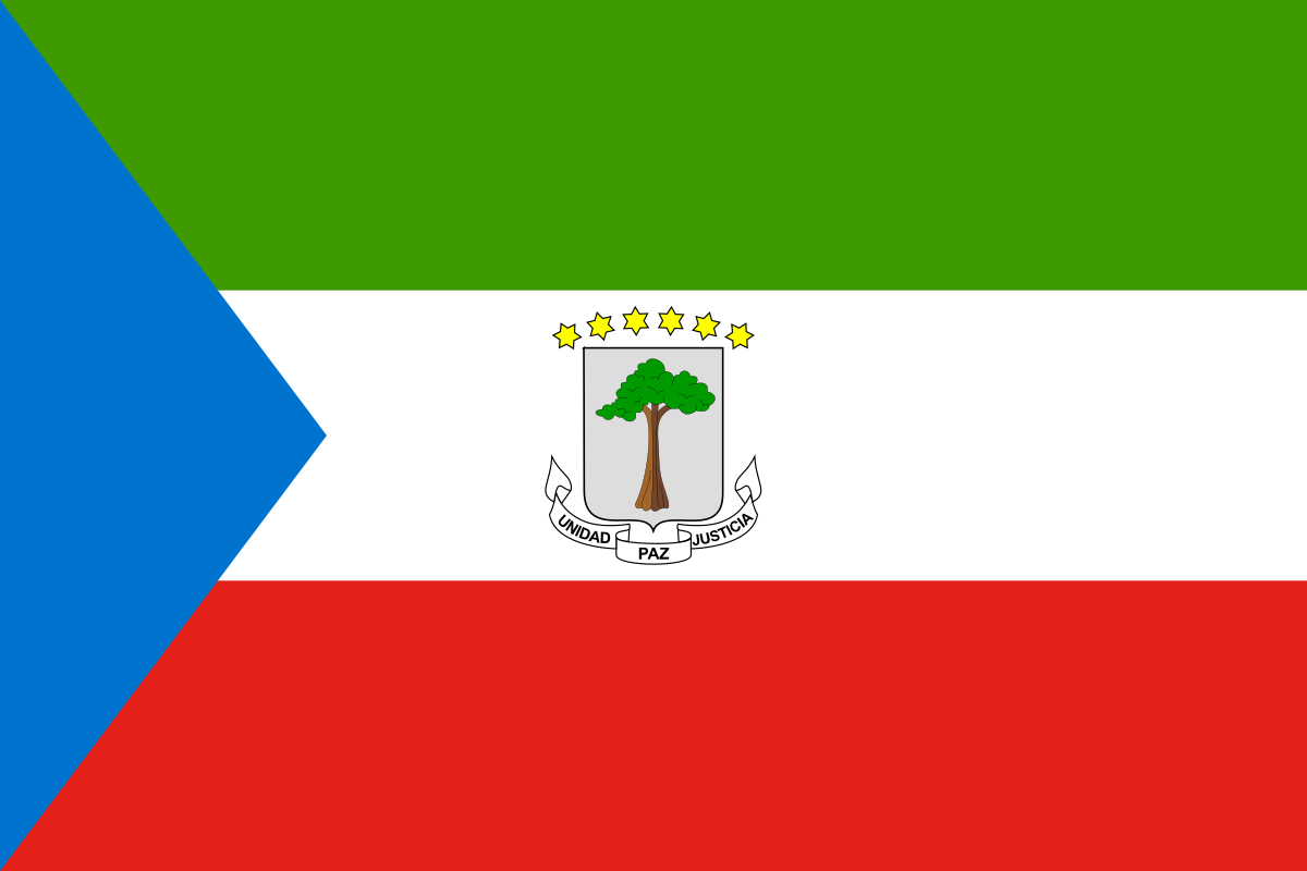
Equatorial Guinea's flag has green, white and red horizontal stripes, a blue triangle at the flagpole side and the national coat of arms in the middle of the white stripe.
Read about this flag →Equatorial Guinea at a glance
- Capital
- Ciudad de la Paz (since January 2026; before that Malabo)
- Continent
- Africa
- Area
- 28,051 km²
- Population
- 1.9 million
Equatorial Guinea is a small country in Central Africa, made up of a mainland region called Río Muni, between Cameroon and Gabon, and several islands in the Gulf of Guinea, the largest of which is Bioko. It is the only country in Africa where Spanish is an official language. About 1.9 million people live there. Its long-time capital, Malabo, is on Bioko, and the government has been moving the capital to Ciudad de la Paz, a new city built on the mainland. The country is known for its rainforests, volcanic islands and oil.
On My Earth Toy you can see St. Elizabeth's Cathedral in Malabo, a twin-towered Gothic-style church completed in 1916.
Geography and nature
Bioko is a volcanic island with steep, forested slopes; its highest peak, Pico Basilé, rises above 3,000 metres. Its forests are home to rare monkeys such as drills and several kinds of colobus, and sea turtles nest on its southern beaches. Río Muni, on the mainland, is low and covered in thick rainforest, crossed by rivers. Annobón, a tiny island far to the southwest, lies south of the Equator. The climate is hot and wet all year.
People, languages and culture
The largest ethnic group is the Fang, who live mainly on the mainland, while the Bubi are the original people of Bioko. Spanish, French and Portuguese are official languages, and Fang, Bubi and other local languages are spoken at home. Most people are Christian. Music and dance, such as the balélé dance of Bioko, are important at festivals. Fish, cassava and plantains are common foods.
History in a nutshell
The Portuguese explorer Fernão do Pó sighted Bioko in the 1470s, and the island was named after him for centuries. Portugal handed the region to Spain in 1778. Spanish Guinea grew cocoa and coffee on plantations. The country became independent from Spain on 12 October 1968 as Equatorial Guinea. Large offshore oil reserves were discovered in the 1990s, transforming the economy.
Fun facts
- The name Equatorial Guinea refers to the country's location near the Equator and in the Gulf of Guinea region.
- Malabo used to be called Santa Isabel.
- Bioko was once connected to the African mainland when sea levels were lower during the last ice age.
- The Goliath frog, the largest frog in the world, also lives in rivers of Equatorial Guinea's mainland.
Famous landmarks in Equatorial Guinea
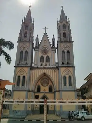
St. Elizabeth's Cathedral, Malabo
Equatorial Guinea · Africa
A neo-Gothic cathedral from 1916 overlooking the bay of Malabo; its twin 40-metre spires are the symbol of the city.
Questions
What is the capital of Equatorial Guinea?
The capital of Equatorial Guinea is Ciudad de la Paz (since January 2026; before that Malabo).
Which continent is Equatorial Guinea in?
Equatorial Guinea is in Africa.
How big is Equatorial Guinea?
Equatorial Guinea covers about 28,051 km².
How many people live in Equatorial Guinea?
About 1.9 million people live in Equatorial Guinea.
What are the most famous landmarks in Equatorial Guinea?
On My Earth Toy's free 3D globe, the landmark from Equatorial Guinea is St. Elizabeth's Cathedral, Malabo, with a photo and quick facts.
Sources
Updated: 2026-10-30