
Eritrea: landmarks, animals & facts for kids
1 landmark
Eritrea on My Earth Toy, the free 3D toy globe for kids: 1 landmark. Here you can see its flag, capital and size, then fly to every place on the globe.
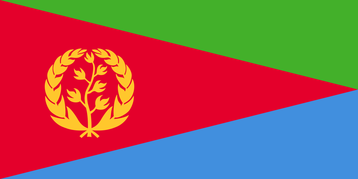
Eritrea's flag has a big red triangle pointing from the flagpole to the far edge, a green triangle above it and a blue one below, and a golden olive wreath and branch in the red.
Read about this flag →Eritrea at a glance
- Capital
- Asmara
- Continent
- Africa
- Area
- 117,600 km²
- Population
- 3.5 million
Eritrea is a country in the Horn of Africa, with a long coastline on the Red Sea. It is bordered by Sudan, Ethiopia and Djibouti, and it includes the Dahlak Archipelago, a group of islands off the coast. Its capital is Asmara, a highland city famous for its Italian-era modernist buildings, and a few million people live in the country. Eritrea is known for its dramatic highlands, hot desert coast and coral islands.
On My Earth Toy you can see the Fiat Tagliero Building in Asmara, a petrol station from 1938 shaped like an aeroplane, with two long concrete wings that stick out about 15 metres without any supports underneath.
Geography and nature
A high plateau runs through the middle of Eritrea, where Asmara sits at about 2,300 metres above sea level, so the weather there is mild. To the east the land falls steeply to a hot, dry coastal plain along the Red Sea. In the southeast lies part of the Danakil Depression, one of the hottest places on Earth. The western lowlands have savanna. Coral reefs around the Dahlak islands are home to dolphins, dugongs and sea turtles.
People, languages and culture
Eritrea has nine recognised ethnic groups, including the Tigrinya and Tigre. There is no single official language; Tigrinya, Arabic and English are used most in government and schools. Christianity and Islam are the main religions. Injera, a spongy sourdough flatbread, is eaten with spicy stews. Cycling is hugely popular, a tradition that began in Italian times, and Eritrean riders have competed in top international races.
History in a nutshell
The powerful Kingdom of Aksum, based in Eritrea and northern Ethiopia, traded across the Red Sea about 2,000 years ago. Later the coast was controlled by the Ottomans and Egyptians. Italy made Eritrea a colony in 1890 and built much of Asmara. Britain ran it after 1941, then it was joined with Ethiopia. After a 30-year war of independence, Eritrea became independent in 1993 following a referendum.
Fun facts
- Asmara was added to the UNESCO World Heritage List in 2017 as a modernist African city.
- The Fiat Tagliero Building's wings were so daring that builders feared they would collapse, but they are still standing.
- Eritrea's Red Sea coastline is more than 1,000 kilometres long.
- Eritrea's flag shows a gold olive branch inside a wreath, a symbol of peace.
Famous landmarks in Eritrea
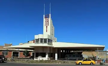
Fiat Tagliero Building
Eritrea · Africa
A Futurist service station built in Asmara in 1938, its two 15 m concrete wings cantilevered without columns so it looks like an aeroplane taking off.
Questions
What is the capital of Eritrea?
The capital of Eritrea is Asmara.
Which continent is Eritrea in?
Eritrea is in Africa.
How big is Eritrea?
Eritrea covers about 117,600 km².
How many people live in Eritrea?
About 3.5 million people live in Eritrea.
What are the most famous landmarks in Eritrea?
On My Earth Toy's free 3D globe, the landmark from Eritrea is Fiat Tagliero Building, with a photo and quick facts.
Sources
Updated: 2026-10-30