
Mauritania: landmarks, animals & facts for kids
1 landmark
Mauritania on My Earth Toy, the free 3D toy globe for kids: 1 landmark. Here you can see its flag, capital and size, then fly to every place on the globe.
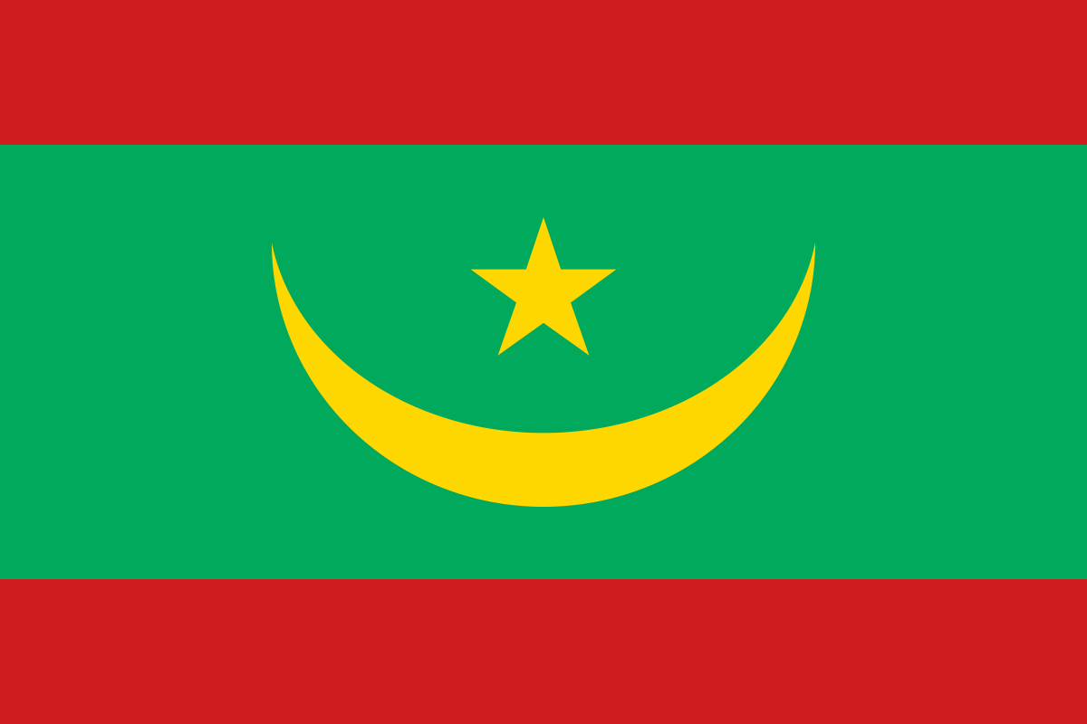
Mauritania's flag is green with a golden crescent moon and star in the middle, and a red band along the top and bottom.
Read about this flag →Mauritania at a glance
- Capital
- Nouakchott
- Continent
- Africa
- Area
- 1,030,700 km²
- Population
- 5.2 million
Mauritania is a country in northwest Africa on the Atlantic Ocean, bordered by Western Sahara, Algeria, Mali and Senegal. Its capital is Nouakchott, on the coast. Most of Mauritania lies in the Sahara Desert, so the majority of people live in the two biggest cities or along the Senegal River in the south. It links the Arab Maghreb of North Africa with the Sahel of West Africa, and is known for desert caravan towns, rich fishing waters and huge iron-ore trains.
On My Earth Toy you can see the Richat Structure, a giant set of rings in the desert, about 40 kilometres across, nicknamed the Eye of the Sahara. It is so big that astronauts use it as a landmark.
Geography and nature
Sand dunes, rocky plateaus and gravel plains cover most of Mauritania. The highest point, Kediet Ijill, is a mountain of iron ore 915 metres tall. The Richat Structure is not a meteor crater; geologists think it is a dome of rock that was pushed up and then worn away, leaving rings of hard and soft rock. On the coast, Banc d'Arguin National Park, a UNESCO site, has mudflats where millions of migrating shorebirds rest, and the sea is rich in fish.
People, languages and culture
Arabic is the official language, and Pular, Soninke and Wolof are national languages; French is also used. Nearly all Mauritanians are Muslim. The population includes Arabic-speaking Moors and Black African communities such as the Fula, Soninke and Wolof. Many families have nomadic roots, raising camels, goats and sheep. Drinking sweet green mint tea in three small glasses is an important ritual of welcome. Old oasis towns such as Chinguetti and Ouadane hold libraries of handwritten manuscripts.
History in a nutshell
Thousands of years ago, when the Sahara was greener, people left rock paintings here. Later, Berber groups controlled trade routes across the desert, and in the 11th century the Almoravid movement began in this region and went on to rule Morocco and parts of Spain. Caravan towns like Chinguetti and Ouadane grew up along these routes. France made the area a colony in the early 20th century, and Mauritania became independent on 28 November 1960.
Fun facts
- Mauritania's iron-ore trains are among the longest and heaviest in the world, often about 2 kilometres long.
- The Richat Structure is easy to see from space but hard to notice when standing on the ground inside it.
- Chinguetti was once an important gathering place for pilgrims travelling to Mecca.
- Banc d'Arguin is one of the most important places on Earth for migrating shorebirds.
Famous landmarks in Mauritania
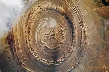
Richat Structure
Mauritania · Africa
A 40 km-wide eroded dome of concentric rock rings in the Sahara, so striking from space that it is nicknamed the Eye of the Sahara.
Questions
What is the capital of Mauritania?
The capital of Mauritania is Nouakchott.
Which continent is Mauritania in?
Mauritania is in Africa.
How big is Mauritania?
Mauritania covers about 1,030,700 km².
How many people live in Mauritania?
About 5.2 million people live in Mauritania.
What are the most famous landmarks in Mauritania?
On My Earth Toy's free 3D globe, the landmark from Mauritania is Richat Structure, with a photo and quick facts.
Sources
Updated: 2026-10-30