
Vanuatu: landmarks, animals & facts for kids
1 landmark
Vanuatu on My Earth Toy, the free 3D toy globe for kids: 1 landmark. Here you can see its flag, capital and size, then fly to every place on the globe.
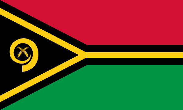
Red on top and green below, with a black triangle at the left and a yellow, black-edged Y shape lying on its side. On the triangle is a gold boar's tusk curled in a circle around two crossed namele leaves.
Read about this flag →Vanuatu at a glance
- Capital
- Port Vila
- Continent
- Oceania
- Area
- 12,189 km²
- Population
- 0.3 million
Vanuatu is an island country in the South Pacific Ocean, in the region called Melanesia, east of northern Australia and west of Fiji. It is a Y-shaped chain of about 80 islands, many of them volcanic. The capital, Port Vila, is on the island of Efate.
Vanuatu is known for its active volcanoes, coral reefs, friendly villages and an astonishing number of languages. On the globe you can find Chief Roi Mata's Domain, a UNESCO World Heritage Site on Efate and nearby islands, linked to a powerful chief who lived around the year 1600 and whose story is still told today.
Geography and nature
Vanuatu sits on the Pacific Ring of Fire, and several of its volcanoes are active. On Tanna Island, visitors can walk to the rim of Mount Yasur and watch it throw glowing lava into the air, and Ambrym has lava lakes in its craters. The islands are covered in rainforest, and the seas around them have coral reefs and famous wrecks for divers. Earthquakes and cyclones are part of life. Flying foxes, colourful birds and sea turtles are among the wildlife.
People, languages and culture
More than 100 local languages are spoken in Vanuatu, one of the highest numbers per person anywhere in the world. Bislama, a creole language, helps everyone understand each other, and English and French are also official. Most people are Christian and live in villages, following kastom, their traditional ways. Sand drawing, in which a story is traced in one continuous line, is listed by UNESCO. Kava, a drink made from a pepper plant root, is shared at gatherings, and lap lap, a baked pudding of root vegetables, is a favourite food.
History in a nutshell
People arrived in Vanuatu about 3,000 years ago. Around 1600, the chief known as Roi Mata ruled over central Vanuatu; after his death he was buried on a small island along with members of his household. A Spanish expedition arrived in 1606, and Captain James Cook named the islands the New Hebrides in 1774. From 1906 Britain and France ruled the islands together, a rare arrangement called a condominium. Vanuatu became independent on 30 July 1980.
Fun facts
- On Pentecost Island, men dive from tall wooden towers with vines tied to their ankles in the land-diving ceremony, an ancestor of bungee jumping.
- Vanuatu has an underwater post office near Port Vila, where snorkellers can post waterproof postcards.
- Mount Yasur on Tanna has been erupting almost continuously for hundreds of years.
- Under British and French rule, Vanuatu had two police forces and two school systems at the same time.
Famous landmarks in Vanuatu
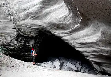
Chief Roi Mata's Domain
Vanuatu · Oceania
Sites linked to the early-17th-century paramount chief Roi Mata: his residence at Mangaas, the painted Fels Cave on Lelepa, and hat-shaped Artok (Hat Island), where he was buried with his retinue.
Questions
What is the capital of Vanuatu?
The capital of Vanuatu is Port Vila.
Which continent is Vanuatu in?
Vanuatu is in Oceania.
How big is Vanuatu?
Vanuatu covers about 12,189 km².
How many people live in Vanuatu?
About 0.3 million people live in Vanuatu.
What are the most famous landmarks in Vanuatu?
On My Earth Toy's free 3D globe, the landmark from Vanuatu is Chief Roi Mata's Domain, with a photo and quick facts.
Sources
Updated: 2026-10-30