
Libya: landmarks, animals & facts for kids
1 landmark · 1 animal · 1 place to discover
Libya on My Earth Toy, the free 3D toy globe for kids: 1 landmark, 1 animal, 1 place to discover. Here you can see its flag, capital and size, then fly to every place on the globe.
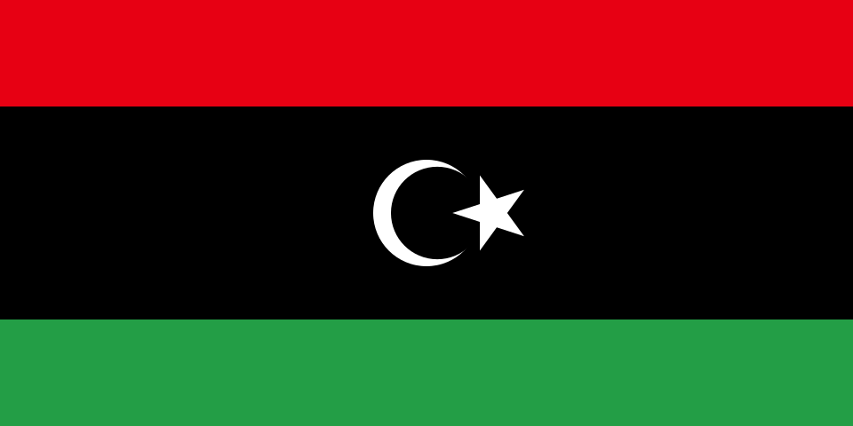
Red, black and green horizontal stripes, with the black stripe twice as wide and a white crescent and star in its centre.
Read about this flag →Libya at a glance
- Capital
- Tripoli
- Continent
- Africa
- Area
- 1,759,540 km²
- Population
- 7.4 million
Libya is a large country in North Africa with a long coastline on the Mediterranean Sea, between Egypt, Sudan, Chad, Niger, Algeria and Tunisia. Its capital is Tripoli. More than 90 percent of Libya is desert, part of the Sahara, so most people live along the coast. Libya is known for its spectacular Roman and Greek ruins, desert oases, prehistoric rock art and large oil reserves.
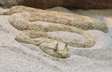
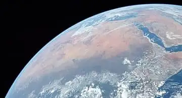
On My Earth Toy you can explore Leptis Magna, one of the best-preserved Roman cities in the Mediterranean, with its theatre, market and grand arches by the sea. Look for the Saharan horned viper, a desert snake with little horns over its eyes, and discover the Sahara, the largest hot desert on Earth.
Geography and nature
Libya's coast has a mild Mediterranean climate, but inland the land quickly turns into sand seas, rocky plateaus and mountains such as the Tibesti on the border with Chad, where Bikku Bitti reaches 2,267 metres. The country has no permanent rivers. Instead, a huge project called the Great Man-Made River pumps ancient groundwater from deep beneath the desert to coastal cities. In the far south, the Waw an Namus volcano has small lakes inside its crater.
People, languages and culture
Arabic is the official language, and Amazigh (Berber) languages such as Tamazight and Tamasheq are spoken in some regions. Almost all Libyans are Sunni Muslims. The old desert town of Ghadames, with its white mud-brick houses connected by shaded covered alleys, is a UNESCO World Heritage Site. In the Acacus Mountains, rock paintings and carvings thousands of years old show giraffes, cattle and people from a time when the Sahara was green. Couscous and spicy soups are popular dishes.
History in a nutshell
Phoenicians founded trading towns on the west coast, and Greeks built the city of Cyrene in the east. The region became part of the Roman Empire, and Leptis Magna was the birthplace of Emperor Septimius Severus. Arab armies brought Islam in the 7th century, and later the Ottoman Empire ruled. Italy colonised Libya in 1911. On 24 December 1951, Libya became an independent kingdom. Muammar Gaddafi ruled from 1969 until 2011, and since then the country has gone through periods of conflict.
Fun facts
- A reading of 58°C at Al-Aziziya in Libya was long listed as the world's hottest temperature, until experts rejected it in 2012.
- Ancient rock art in the Acacus Mountains shows animals like giraffes and elephants, proof that the Sahara was once much wetter.
- Libya was the first country to become independent through a decision of the United Nations.
- The Great Man-Made River is one of the largest water pipeline projects in the world.
Famous landmarks in Libya
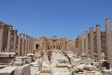
Leptis Magna
Libya · Africa
Spectacular Roman city ruins on the Mediterranean, birthplace of Emperor Septimius Severus.
Animals in Libya
Places to discover in Libya
Questions
What is the capital of Libya?
The capital of Libya is Tripoli.
Which continent is Libya in?
Libya is in Africa.
How big is Libya?
Libya covers about 1,759,540 km².
How many people live in Libya?
About 7.4 million people live in Libya.
What are the most famous landmarks in Libya?
On My Earth Toy's free 3D globe, the landmark from Libya is Leptis Magna, with a photo and quick facts.
Which animals can you find in Libya on My Earth Toy?
On the globe you can find Saharan horned viper in Libya.
Sources
Updated: 2026-10-30